Scenic Loop: Stalingradkreuz Kohlanger Rastanger Weg
Embark on an unforgettable journey along the Stalingradkreuz Kohlanger Rastanger Weg, a picturesque trail located in the stunning landscapes of Aigen im Ennstal. Spanning approximately 11.8 kilometers, this trail offers a delightful mix of serene forests and open meadows, making it suitable for hikers of all skill levels. As you traverse the path, you will be captivated by the breathtaking views of the surrounding mountains, lush greenery, and tranquil streams. The trail features well-maintained pathways, making it easy to navigate while providing opportunities to connect with nature. Along the way, you may encounter local wildlife and diverse flora, adding to the charm of this hike. Whether you're looking for a peaceful day in the great outdoors or a family-friendly adventure, the Stalingradkreuz Kohlanger Rastanger Weg is a perfect choice.
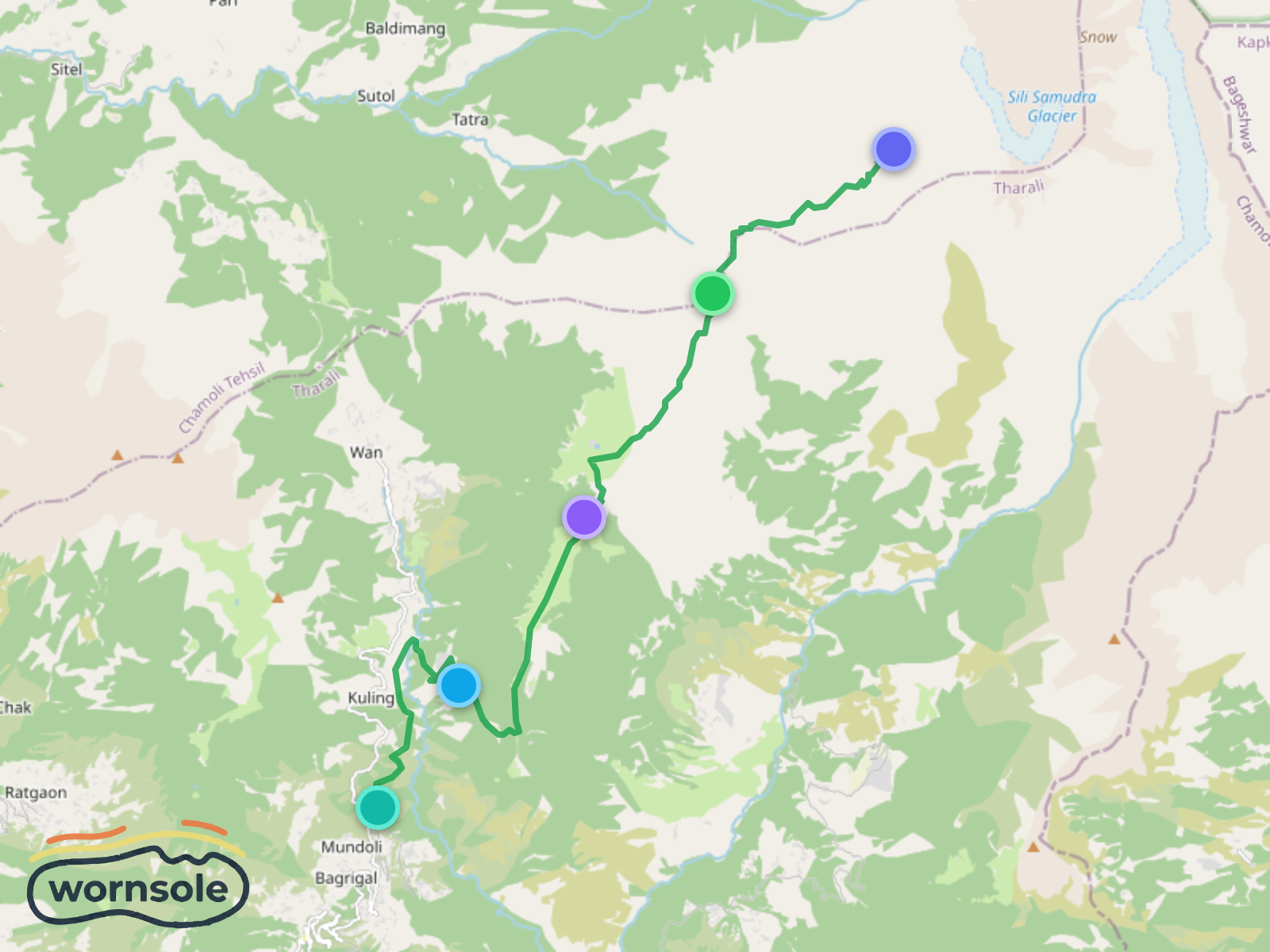
Lohajung to Roopkund: The Mystical Journey to the Skeleton Lake
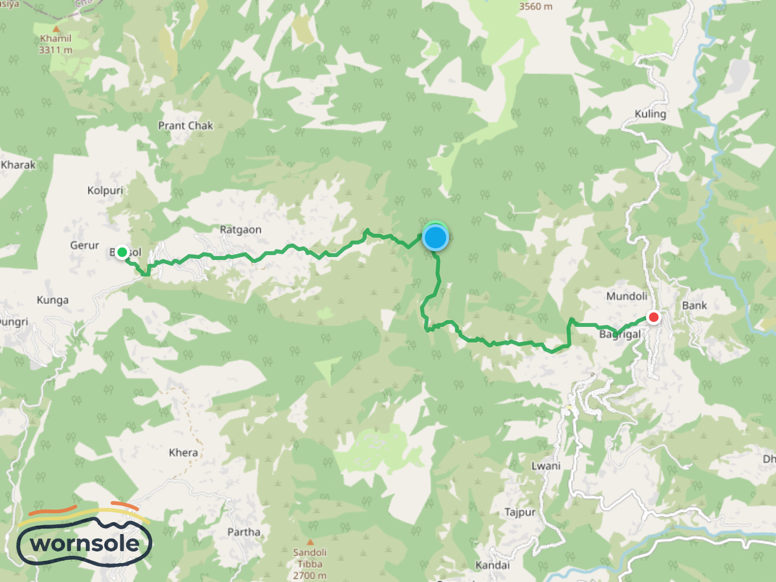
Scenic Trek from Lohajung to Bursol: A Journey Through Majestic Landscapes
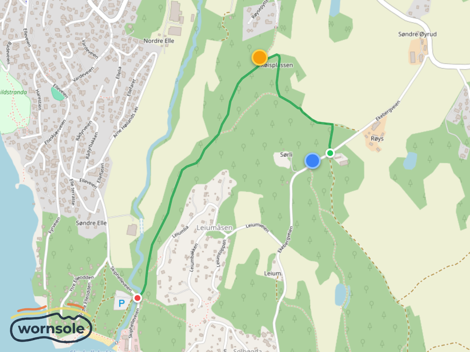
Scenic Røis to Skiphelle Coastal Trail
Mahlkinzig to Degental: A Scenic Short Hike in the Black Forest
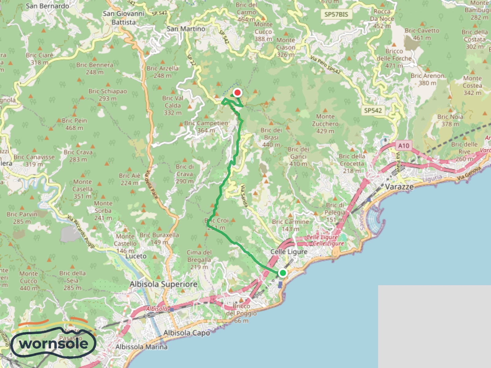
Coastal Exploration: Celle Ligure to Bric delle Forche
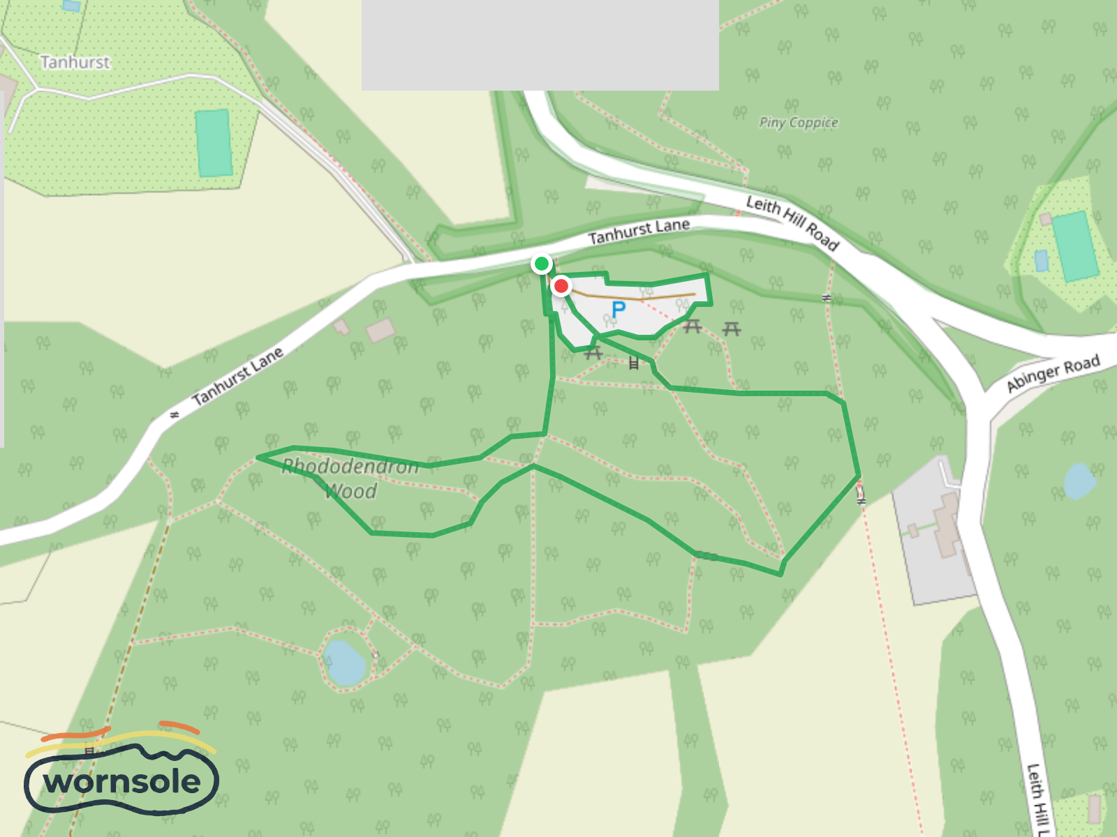
Rhododendron Wood Walk at Leith Hill
Distance
11.8km
Difficulty
Moderate
Est. Time
3-4 hours
Terrain
Best Seasons
Parking
PARKING
Rest Area
REST AREA
Parking
PARKING
Parking
PARKING
Parking
PARKING
Parking
PARKING
Rest Area
REST AREA
Rest Area
REST AREA
Rest Area
REST AREA
Mayerhofer Monika Bankerl
VIEWPOINT
Rest Area
REST AREA
P1 für Wanderer Stalingradkreuz Kohlanger (Weg 9) und Hohe Trett
PARKING
Water Source
WATER SOURCE
P2 für Wanderer Stalingradkreuz Kohlanger (Weg 9) und Hohe Trett
PARKING
Viewpoint
VIEWPOINT
Kohlanger
SUMMIT
Rastanger
SUMMIT
Rest Area
REST AREA
Rest Area
REST AREA
Parking
PARKING
Rest Area
REST AREA
Parking
PARKING
Water Source
WATER SOURCE
Map Maker
Published 1/30/2026