Explore the Scenic Pennine Bridleway: A Journey Through Nature's Beauty
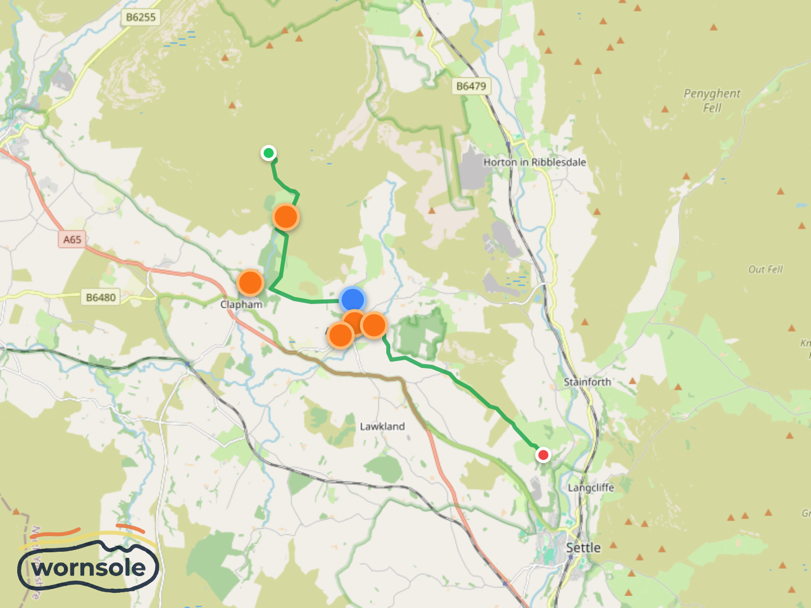
The Pennine Bridleway is a stunning long-distance trail that spans 193 kilometers through the heart of England, showcasing the breathtaking landscapes of the Pennine mountain range. This trail is perfect for those looking to immerse themselves in nature, as it winds through rolling hills, picturesque valleys, and charming villages. Hikers can expect a variety of terrains, from lush meadows to rocky outcrops, providing a diverse outdoor experience. The route is primarily designed for horse riders and cyclists, making it a unique opportunity for walkers to enjoy the tranquil beauty of the countryside. Along the way, you will encounter historic landmarks, including ancient stone walls and remnants of the region's rich heritage. The trail offers a chance to spot local wildlife and take in panoramic views that are simply unforgettable. Whether you're seeking a peaceful day hike or a longer adventure, the Pennine Bridleway promises a memorable experience filled with natural wonders.
Epic Adventure on A Pennine Journey
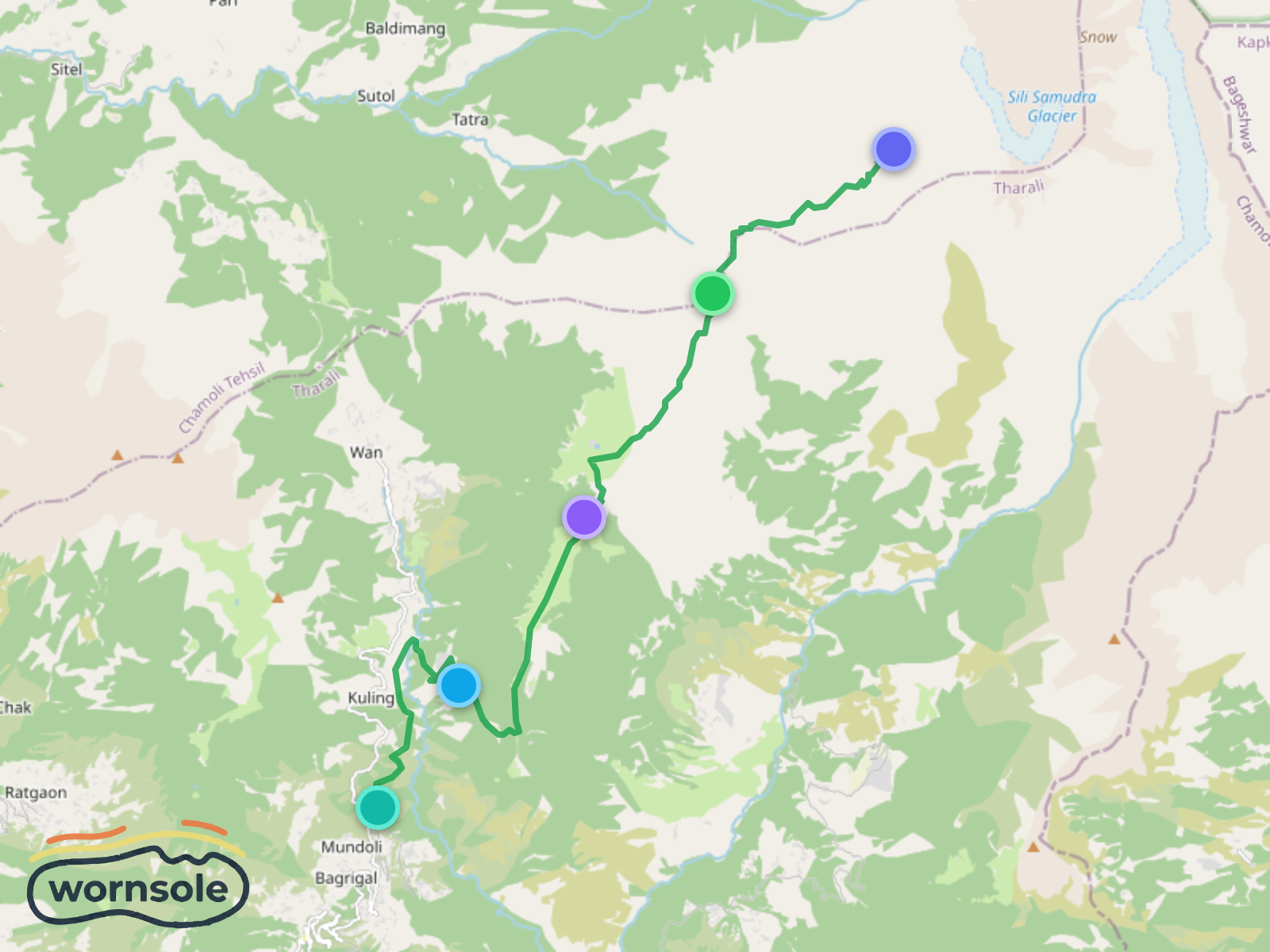
Lohajung to Roopkund: The Mystical Journey to the Skeleton Lake
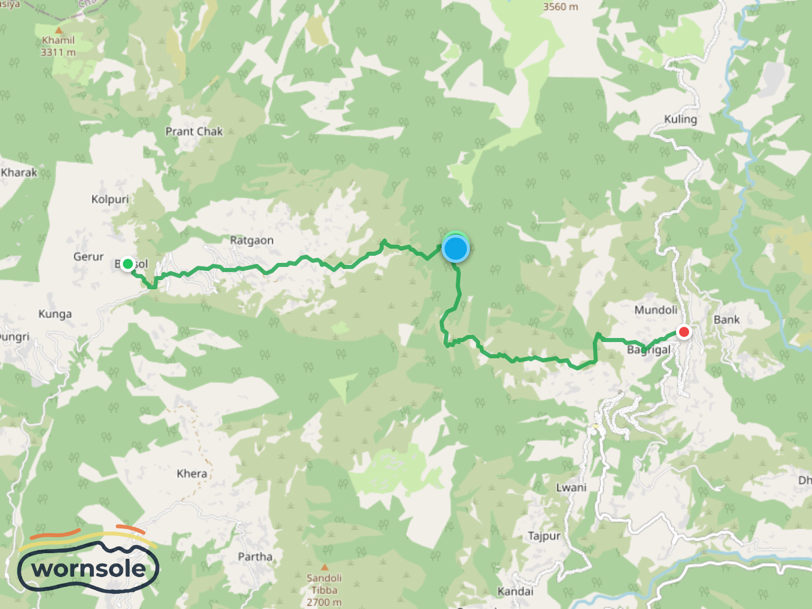
Scenic Trek from Lohajung to Bursol: A Journey Through Majestic Landscapes
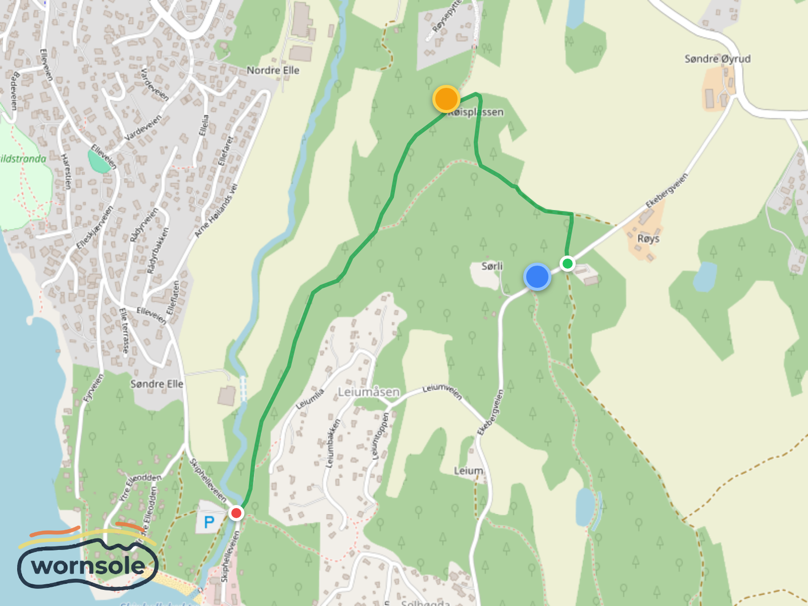
Scenic Røis to Skiphelle Coastal Trail
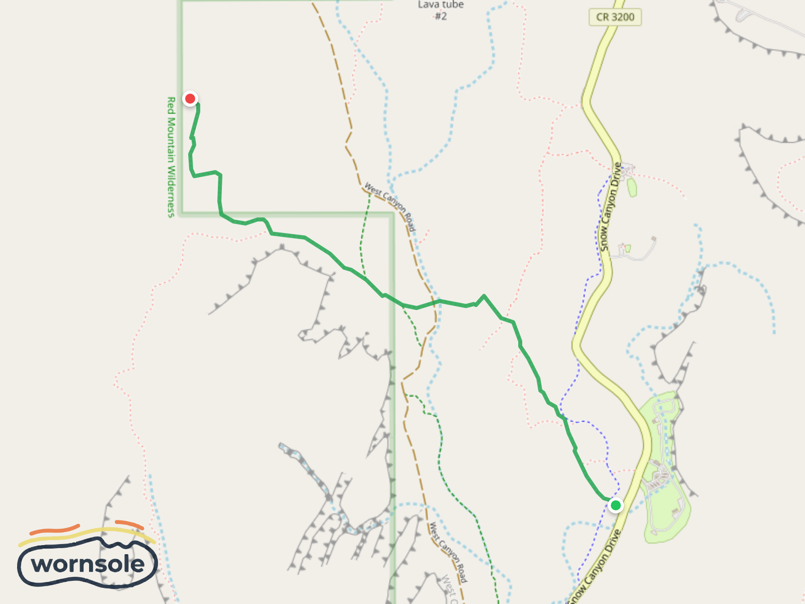
Red Sands Adventure Loop
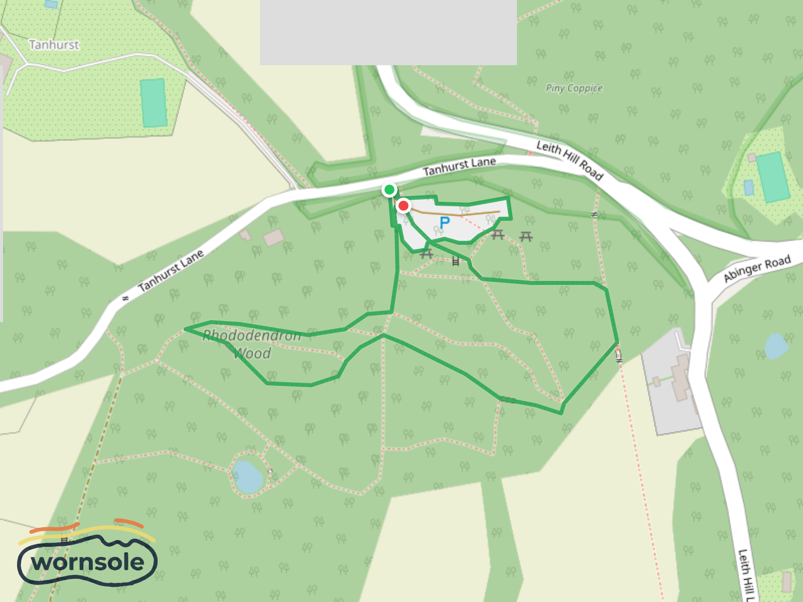
Rhododendron Wood Walk at Leith Hill
Distance
193.0km
Difficulty
Moderate
Est. Time
5-7 days
Terrain
Best Seasons
Layby
PARKING
Parking
PARKING
Parking
PARKING
Middleton Top Campsite (Caravan & Camping Club)
CAMPING SPOT
Rest Area
REST AREA
For coaches and horseboxes
PARKING
Rest Area
REST AREA
Water Source
WATER SOURCE
Minninglow
REST AREA
Patch of gravel at the side of the road
PARKING
Hurdlow
REST AREA
Rest Area
REST AREA
Water Source
WATER SOURCE
Rest Area
REST AREA
Layby
PARKING
Rest Area
REST AREA
Rest Area
REST AREA
Rest Area
REST AREA
Rest Area
REST AREA
Rest Area
REST AREA
Rest Area
REST AREA
Rest Area
REST AREA
Campsite
CAMPING SPOT
Rest Area
REST AREA
Campsite
CAMPING SPOT
Rest Area
REST AREA
Lantern Pike
SUMMIT
Rest Area
REST AREA
Rest Area
REST AREA
Rest Area
REST AREA
Rest Area
REST AREA
Rest Area
REST AREA
Rest Area
REST AREA
Rest Area
REST AREA
Rest Area
REST AREA
Rest Area
REST AREA
Rest Area
REST AREA
Rest Area
REST AREA
Water Source
WATER SOURCE
Rest Area
REST AREA
Diggle Water Point
WATER SOURCE
Rest Area
REST AREA
Stormer Hill
SUMMIT
Rest Area
REST AREA
Rest Area
REST AREA
Rest Area
REST AREA
Rest Area
REST AREA
Rest Area
REST AREA
Viewpoint
VIEWPOINT
Middle Breaks Hill
SUMMIT
Ha-ha Hill
SUMMIT
Green Hill
SUMMIT
Weets Hill
SUMMIT
Todmanhaw
SUMMIT
Low High Hill
SUMMIT
Rest Area
REST AREA
Rest Area
REST AREA
Rest Area
REST AREA
Rest Area
REST AREA
Rest Area
REST AREA
Parking
PARKING
Rest Area
REST AREA
Viewpoint
VIEWPOINT
Scald Bank
SUMMIT
Gill Rigg
SUMMIT
Water Source
WATER SOURCE
Rest Area
REST AREA
Rest Area
REST AREA
Rest Area
REST AREA
Map Maker
Published 1/30/2026