Explore the Enchanting Valley of Wild Endert
The Im Tal der wilden Endert trail offers an immersive hiking experience through the stunning landscapes of the Eifel region. Spanning 20.6 kilometers, this trail meanders along the picturesque Endert River, inviting hikers to enjoy a blend of lush forest paths and open meadows. The terrain is predominantly gentle, making it accessible for a variety of skill levels. As you navigate the trail, you'll encounter diverse flora and fauna, making it a perfect spot for nature enthusiasts and photographers alike. The trail showcases the charm of the Eifel's rugged hills and serene waterways, with occasional viewpoints that reveal breathtaking vistas of the surrounding landscape. With well-marked paths maintained by the Eifelverein, this trail ensures a safe and enjoyable hike, ideal for families and casual hikers looking to reconnect with nature.
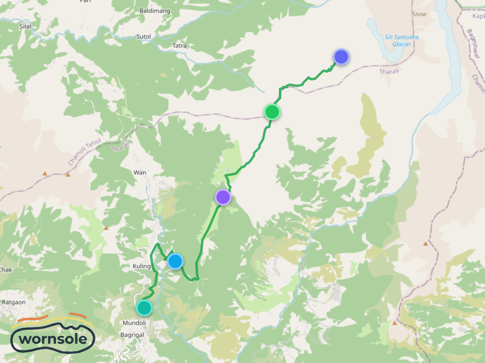
Lohajung to Roopkund: The Mystical Journey to the Skeleton Lake
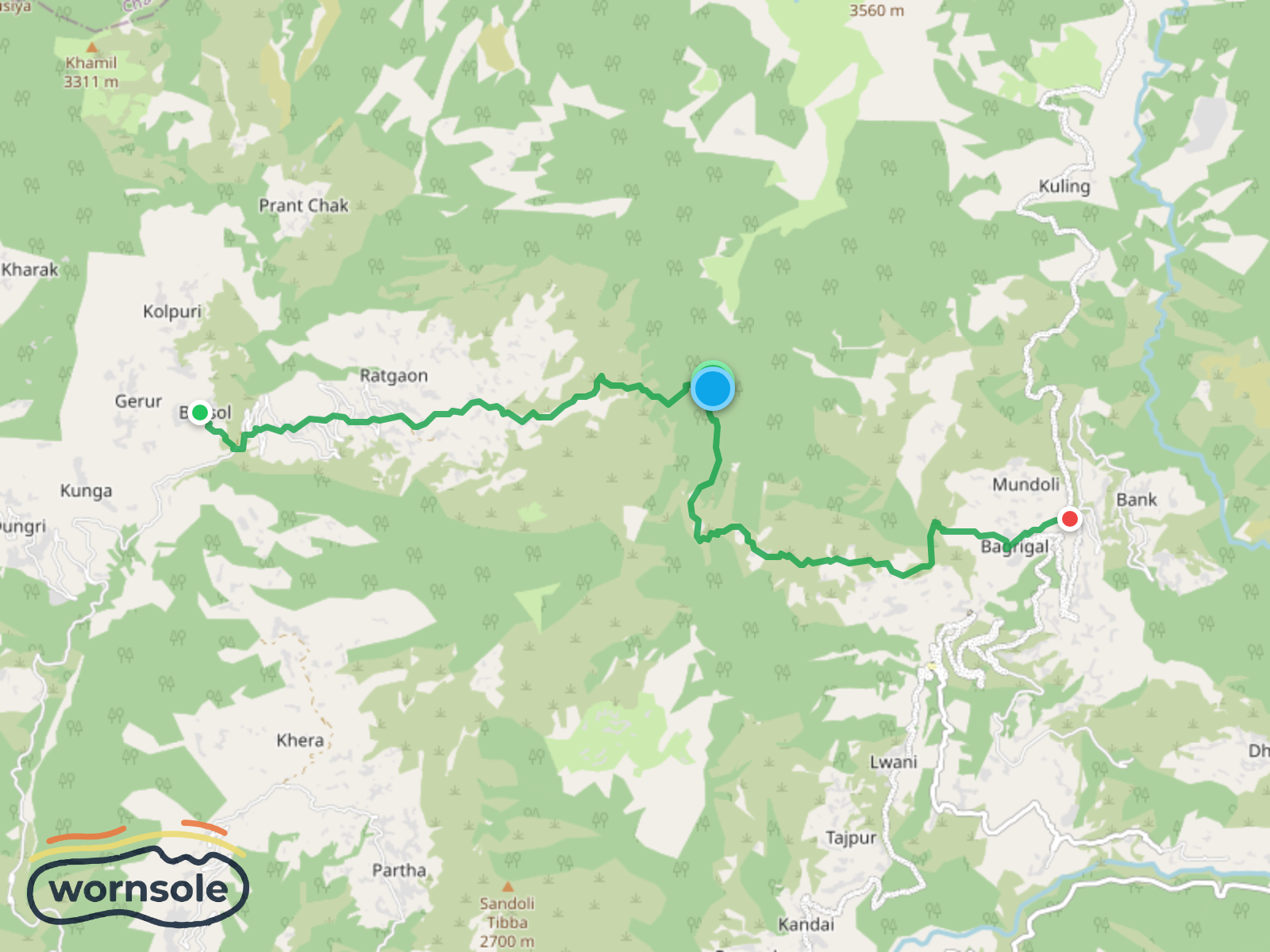
Scenic Trek from Lohajung to Bursol: A Journey Through Majestic Landscapes
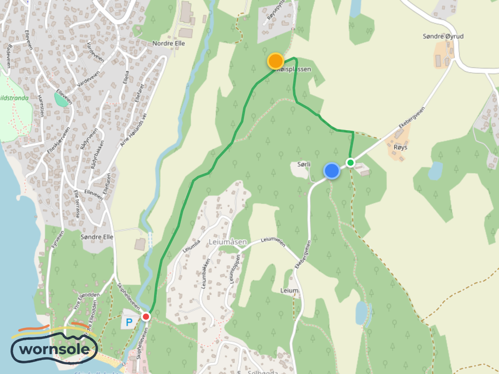
Scenic Røis to Skiphelle Coastal Trail
Mahlkinzig to Degental: A Scenic Short Hike in the Black Forest
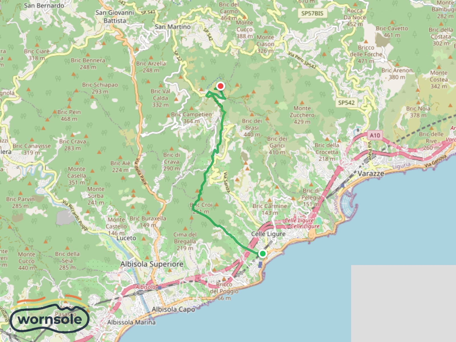
Coastal Exploration: Celle Ligure to Bric delle Forche
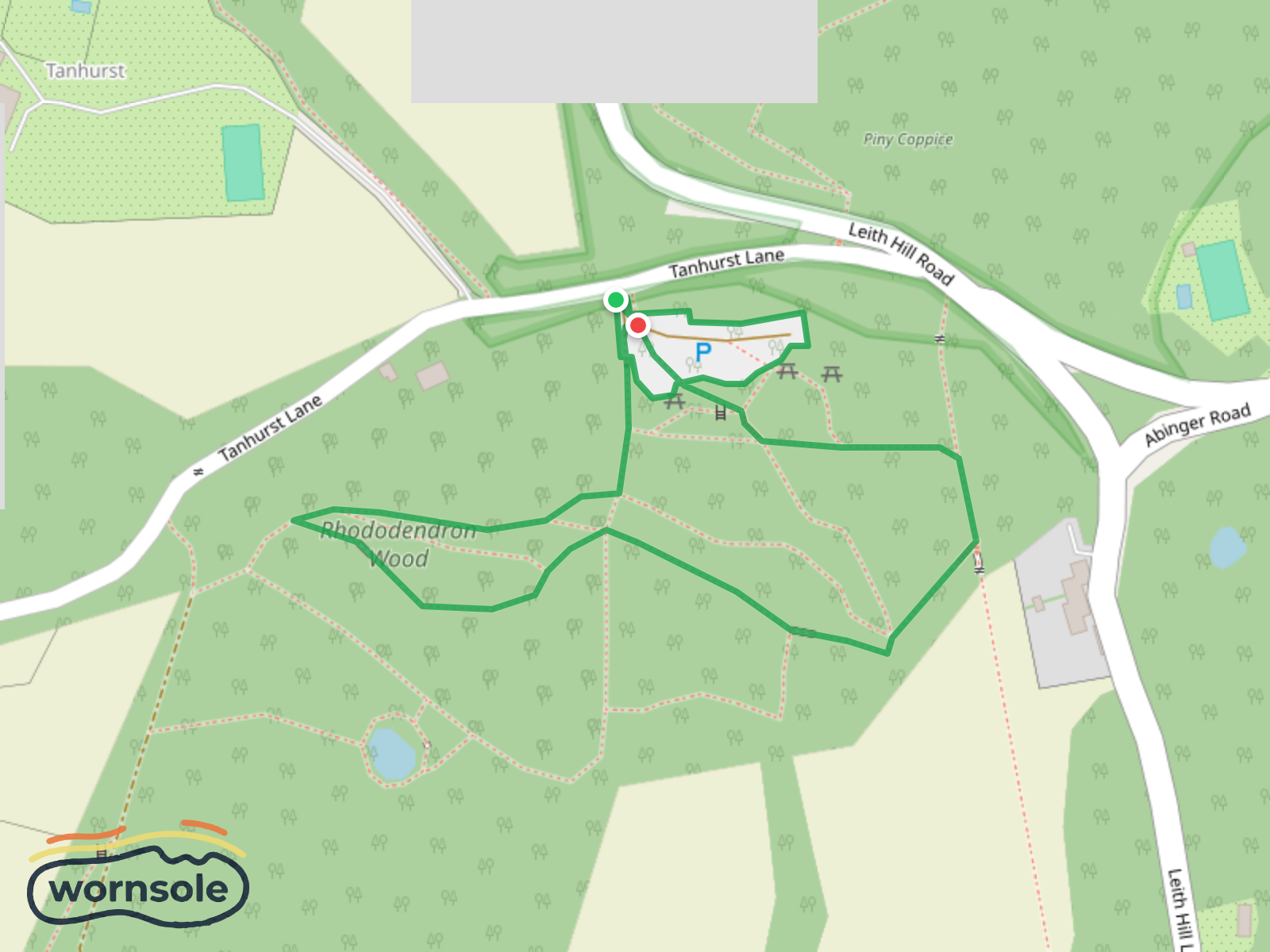
Rhododendron Wood Walk at Leith Hill
Distance
20.6km
Difficulty
Moderate
Est. Time
4-5 hours
Terrain
Best Seasons
Parking
PARKING
Rest Area
REST AREA
Rest Area
REST AREA
Parking
PARKING
Parking
PARKING
Parking
PARKING
Parking
PARKING
Parking
PARKING
Rest Area
REST AREA
Parking
PARKING
Viewpoint
VIEWPOINT
Rest Area
REST AREA
Rest Area
REST AREA
Parking
PARKING
Parking
PARKING
Shelter
SHELTER
Rest Area
REST AREA
Rest Area
REST AREA
Viewpoint
VIEWPOINT
Rest Area
REST AREA
Rest Area
REST AREA
Parking
PARKING
Parking
PARKING
Rest Area
REST AREA
Rest Area
REST AREA
Rest Area
REST AREA
Rest Area
REST AREA
Rest Area
REST AREA
Heimersberg
SUMMIT
Rest Area
REST AREA
Water Source
WATER SOURCE
Water Source
WATER SOURCE
Water Source
WATER SOURCE
Rabenlei
SUMMIT
Water Source
WATER SOURCE
Rest Area
REST AREA
Potsdamer Platz
REST AREA
Rest Area
REST AREA
Rest Area
REST AREA
Viewpoint
VIEWPOINT
"Rote Bank"
REST AREA
Rest Area
REST AREA
Rastplatz Pilz
SHELTER
Viewpoint
VIEWPOINT
Rest Area
REST AREA
Water Source
WATER SOURCE
Blumkurst
SUMMIT
Rest Area
REST AREA
Rest Area
REST AREA
Zickelslei
VIEWPOINT
Rest Area
REST AREA
Zickelslei
SUMMIT
Viewpoint
VIEWPOINT
Rest Area
REST AREA
Rest Area
REST AREA
Rest Area
REST AREA
Rest Area
REST AREA
Viewpoint
VIEWPOINT
Viewpoint
VIEWPOINT
Rest Area
REST AREA
Rest Area
REST AREA
Wackelei
VIEWPOINT
Rest Area
REST AREA
Rest Area
REST AREA
Rest Area
REST AREA
Winneburgblick
VIEWPOINT
Schutzhütte Wilhelmshöhe
SHELTER
Rest Area
REST AREA
Rest Area
REST AREA
Rest Area
REST AREA
Rest Area
REST AREA
Parking
PARKING
Viewpoint
VIEWPOINT
Parking
PARKING
Viewpoint
VIEWPOINT
Rest Area
REST AREA
Rest Area
REST AREA
Pinnerberg
SUMMIT
Viewpoint
VIEWPOINT
Viewpoint
VIEWPOINT
Rest Area
REST AREA
Aussichtspunkt Reichsburg Cochem
VIEWPOINT
Rest Area
REST AREA
Pinnerkreuz;Aussicht Pinnerkreuz
VIEWPOINT
Parking
PARKING
Rest Area
REST AREA
Viewpoint
VIEWPOINT
Rest Area
REST AREA
Rest Area
REST AREA
Viewpoint
VIEWPOINT
Viewpoint
VIEWPOINT
Rest Area
REST AREA
Rest Area
REST AREA
Rest Area
REST AREA
Rest Area
REST AREA
Rest Area
REST AREA
Rest Area
REST AREA
Rest Area
REST AREA
Shelter
SHELTER
Rest Area
REST AREA
Viewpoint
VIEWPOINT
Rest Area
REST AREA
Rest Area
REST AREA
Water Source
WATER SOURCE
Map Maker
Published 1/26/2026